
New Rochelle Neighbor Sources
Public sources answer different questions about New Rochelle neighbors and a block. The county parcel layer maps parcels and stores owner and address fields. The assessment roll adds tax-record context. The City’s permit systems can select an address or several parcels for an application. Voter and civic sources are more limited: the public voter service is person-oriented, and the City association project is voluntary rather than a complete list of local groups. Treat each source as evidence of its own record purpose.
| Source | What It Shows About a Block | Access |
|---|---|---|
| Westchester parcel GIS | New Rochelle parcel polygons, SBL or PRINTKEY, situs, owner fields, property ZIP, class, and adjacent parcel geography | Public ArcGIS viewer and REST layer |
| New Rochelle assessment roll | New Rochelle tax-roll owner, owner mailing field, property location, class, assessment, exemptions, and transfer pointers | Current roll and City assessment resources |
| City DPW permit map | New Rochelle address or map-selected properties used in a Public Works permit application | Current City application workflow |
| NYS voter lookup | New Rochelle individual registration, poll-site, and mail-ballot lookup purpose | Public lookup, not a street export |
| City association project | Planned voluntary New Rochelle association contacts, meetings, boundaries, and City communication channels | City project; completed public list was not located |
| NRPL local history | Dated New Rochelle maps, directories, clippings, and local context for an address | Local History Room and library resources |
A tax owner is not necessarily the person at the door. An owner mailing field may point elsewhere, and a mapped property contains no public utility, mail-recipient, visitor, or complete household information. The sources are most reliable when they are used to check a parcel, a public civic organization, or a dated historical record. Note: A nearby polygon or a tax-roll field is a parcel clue, not proof of present occupancy.
New Rochelle Neighbor Parcel Start
Use the Westchester County parcel viewer to identify the target New Rochelle property first. The New Rochelle parcel layer records MUNNAME, SWIS, SBL, PRINTKEY, property address and ZIP, owner and mailing fields, property class, and school-related fields. Copy the parcel key before comparing any surrounding polygons. It is the bridge between the map, the assessment roll, and later deed or legal-description research.
The research includes a historic official New Rochelle parcel-viewer example for 491 Main Street. Its PRINTKEY was 1-229-0009, while the illustrated nearby Main Street parcels used 1-229-0004 through 1-229-0008. The point of that example is method, not a current roster: each nearby parcel has its own key and must be examined separately. A visible neighboring address does not establish a shared household, shared owner, or current resident.
The parcel geometry also helps with blocks whose addresses are close but not actually adjacent. Compare the polygon edge, street address, and SBL together. If a map search returns more than one similar address, use the municipal and city/town fields to keep the New Rochelle parcel separate from another Westchester location with a similar street name.
New Rochelle Neighbor Parcel Flow
A reproducible New Rochelle block check moves from one exact property to the adjoining parcel records. The order matters because a street name alone can gather too much territory. Keep the target parcel’s SBL or PRINTKEY, property location, and mapped geometry with the notes. Then evaluate each adjacent polygon on its own record rather than copying an owner field across a block.
- Locate the target New Rochelle address in the county GIS viewer or the direct parcel layer. Confirm the property address, municipal field, and SBL or PRINTKEY before moving outward.
- Use map browsing or a spatial relationship query to identify adjoining New Rochelle polygons. Record each nearby parcel key and situs address, not a guessed resident name.
- Check the New Rochelle assessment resources for class, tax owner, mailing field, exemption code, assessment, and any transfer pointer. An owner mailing address remains a mailing clue.
- Use the county clerk, archive, or City record route only for the narrower question at hand. For the full record chain along a named street, use the New Rochelle street directory.
This workflow also leaves a clear audit trail when a block is split, merged, or has condominium records. A parcel key can continue where a casual address comparison fails. The parcel record still stops short of private household membership, so a block map should never be rewritten as a list of people who live there.
New Rochelle Neighbor Map Geometry
The New Rochelle county REST layer supports a more deliberate spatial check than a quick visual pan. Its documented controls include Input Geometry, Geometry Type, Spatial Relationship, Distance, Units, Return Geometry, Result Offset, and Result Record Count. Those fields can reproduce a parcel-neighbor query when a map view is crowded. The unattended research did not verify a viewer-facing buffer button, so it is safer to describe the documented spatial controls than to promise a particular map shortcut.
Use distance carefully. A circle around a New Rochelle address can cross a street, a water edge, or a boundary that does not fit a common understanding of a block. Parcel adjacency is usually clearer when the question is about immediate lots. ZIP and district overlays can add public service or geographic context, yet those overlays are separate from parcel edges and do not establish who is present at a property.
New Rochelle Neighbor Permit Shapes
The New Rochelle City DPW Online Permit System provides a useful demonstration of selecting more than one property. A user can choose an address or map, draw a polygon, circle, or square, add multiple areas, clear shapes, and select Done Adding Properties before adding contacts and documents. It is a practical way to visualize how a public-works application can involve adjacent properties.

The permit screen shows a property-selection workflow, not a neighbor directory. A mapped selection can contain several parcels, and an application contact, owner, or representative attached to it is not proof that every selected property is occupied by the same person.
For a New Rochelle Building Department matter, CitySquared directs users to search with a street number and the first street letters, select the property, and continue through the permit process. Completed permit records may require a records request when the online dashboard does not expose the history. Permits can help date a project or identify an application context, but they do not replace the tax roll or parcel map.
New Rochelle Neighbor Civic Contacts
New Rochelle’s community layer should be approached as voluntary civic information, not as a private membership roll. The New Rochelle City announced a neighborhood-association database initiative on June 10, 2026. It asks active groups to register or update information annually and is intended to support neighborhood updates, meetings, construction and infrastructure information, community resources, events, emergency notices, and City contact. The research did not locate a completed public map or list, so do not assume an association exists for every block.
| Civic Resource | Public Contact or Role | Block Use |
|---|---|---|
| City neighborhood-association database | Voluntary association information, leadership channels, meeting details, and boundaries; City contact Rita Azrelyant, 914-654-2148, razrelya@newrochelleny.gov | Check whether a group has chosen to register and verify its published contact channel. |
| Residence Park Neighborhood & Civic Association | Public mission is residential character, development and improvement, and community welfare; no public member directory was located. | Use the public association contact route for civic context, not for household identification. |
| Rochelle Park–Rochelle Heights historic resources | District material and the Historical and Landmark Review Board provide architectural and development context. | Connect an address to historic documentation without inferring present residents. |
The City neighborhood-association project is the appropriate official starting point for a civic contact channel. The Residence Park association is a named public local source, although the research found no public membership directory. Note: Inclusion in the City project is not an endorsement, and missing information does not show that no civic group exists.
The City project presents voluntary contacts and boundaries as a way to improve communication with active groups. That is useful when a reader wants to know which public organization speaks for a place, but it does not convert a block into a list of private households.
The City neighborhood-association project supplies this official civic-contact reference.
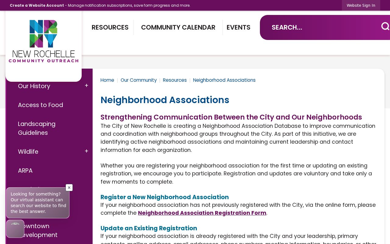
The resource complements the parcel map by adding voluntary community context. Check current City information before relying on a meeting, boundary, or leadership channel because the initiative requests annual verification.
New Rochelle Neighbor Voter Limits
New York’s voter lookup is designed to confirm registration, poll-site, and mail-ballot information for an individual. It accepts county, name, date of birth, New Rochelle address information, and ZIP inputs, but it does not offer a public all-residents-on-a-street control. A full voter-data request is a different channel and must carry the election-purpose statement required by Election Law §3-103(5). Confidential registrations under §5-508 are separately maintained and are not public block-discovery records.
| Record Category | What It Can Offer | Important Limit |
|---|---|---|
| Official parcel and assessment records | Parcel, situs, owner field, mailing field, class, and tax-record context | They do not prove present occupants or complete household membership. |
| Official voter channel | Individual registration-related lookup purpose and statutory request routes | Not a street export; protected registrations remain confidential. |
| Voluntary civic sources | Public association contacts, meetings, or boundaries when an organization publishes them | Participation is voluntary and not a citywide roster. |
| Commercial neighbor-tool category | May compile public and other data into a convenience listing | Accuracy, timing, source coverage, and lawful use require independent checking. |
The most dependable comparison is purpose versus proof. Official parcel records support parcel questions. Official voter channels have election-law limits. Civic pages speak for groups that choose to be public. A commercial category may offer convenience, yet it is not a substitute for checking the current source record and respecting the same privacy limits.
New Rochelle Neighbor Block Context
A New Rochelle block can have a history that is more useful than a current owner field. The New Rochelle Public Library’s E.L. Doctorow Local History Room holds directories, yearbooks, clippings, maps, oral histories, city records, and house-history resources. Historic-district material for Rochelle Park–Rochelle Heights can also connect an address with architectural and development records. These sources place a property in time without claiming that a historical address list describes the current block.
For older New Rochelle parcel work, compare the GIS shape with the dated map or directory notation rather than forcing a modern line onto an old record. The library has 1911 and 1924 Sanborn holdings as well as other atlases, and its staff can help identify non-circulating material. This is the geographic context that a tax roll cannot provide.
New Rochelle Neighbor Privacy
Private household information remains private even when a New Rochelle parcel is easy to map. Public sources do not establish utility customers, mail recipients, visitors, or a full household at an address. The Driver’s Privacy Protection Act also restricts vehicle-owner information, including using a plate or VIN to find an address. A deed or assessment field may contain a name and mailing address, but it should be read within that record’s limited public purpose.
For New Rochelle residents, New York’s Address Confidentiality Program can provide qualifying participants with a substitute mailing address and keeps the actual address confidential except through authorized routes. It cannot remove an address already in an older public record, but agencies must use the substitute address where Executive Law §108 applies unless a waiver is granted. Confidential voter registration is another protected route, with records separately maintained and unavailable for public inspection or copying except to election officials.
Lawful use. Use New Rochelle parcel and civic information for personal, lawful research, local history, or civic awareness. Do not use any source to watch, harass, intimidate, or harm another person.